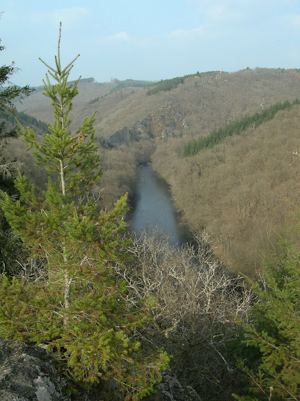
Today, much of the Ardennes is still covered in dense forests. In foreign press I sometimes read it's being described as a mountain range but that's really exxagerated. Generally, the Ardennes average around 350-500 m (1,148-1,640 ft). Only in the northeast does it rise to over 650 m (2,132 ft) in an desolate plateau called the Hautes Fagnes and covered with boggy moors. It is there that you find Belgium's highest point, the Signal de Botrange (694m). But apart from this very distinctive area - possibly the last one in Belgium where you can still really get lost - much of the region is typified by steep-sided valleys carved by fast-flowing rivers, the most prominent being the Meuse which flows through France, Belgium and The Netherlands before ending in the North Sea. The fact that the Ardennes are nowhere near really high could mean they're old, and you bet they are. They were formed during what geologists call the Hercynian orogeny, which makes the Ardennes as old as, say, the Massif Central and the Vosges in France. The Hercynian (or Variscan) orogeny is a geologic mountain-building era caused by the continental collision in the Late Paleozoicum between the supercontinents Laurasia and Gondwana, which formed the hypercontinent of Pangea. Late Paleozoicum means 250-300 million years old, but in the Ardennes you do find rocks that are even older, easily 500 million years. Interesting to know for North Americans is that "simultaneously" with the Hercynian orogeny in "our" neck of the woods, the Acadian and Alleghenian orogeny took place in the area which would later become the United States, forming the Ouachita and Appalachian Mountains. So that would make the Appalachian Mountains about as old as our Ardennes, although - correct me if I'm wrong - I suspect the Appalachians are higher still.
MFBB.
No comments:
Post a Comment