My first stop was in Yvoir, where I hoped to lay my hands on a couple of decent walking maps of the larger area. More precisely I wanted to do a trek from the centre of Yvoir to the ruins of the medieval castle of Poilvache. Alas, no such luck. There wasn't even a Bureau of Tourism. So me off by car, and 'lo and behold, on my GPS display I noticed that a small road veering to the right, a couple of kloms outside Yvoir, was marked 'Chemin de Poilvache'. And indeed, after following it for about two kloms, I came across the old chateau. What remains of it sits on top of a rocky crag overlooking the Meuse river, "Belgium's Rhine":
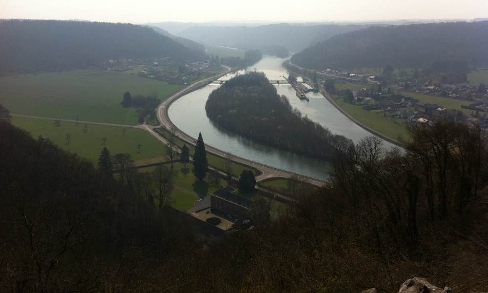
Above a view from the chateaux' ruins down to the Meuse river, with the Ile de Houx in the center.
This was once a room with a view. To the north, to be precise. Quite a commanding position indeed.
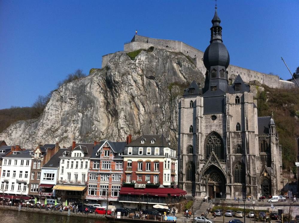
Then it was off to Dinant, 'Daughter of the Meuse', since I assumed that in a town of this (touristic) magnitude the Syndicat du Tourisme would be open so that I could get my walking maps. Btw, the inventor of the saxophone, Adolphe Sax, was born here.
Alas, no such luck. On a glorious Spring day like this one the fonctionnaires of Dinant's Bureau of Tourism were all exhausted from a week's hard work. I did not cross the Meuse for nothing though (I parked my car on the east bank while the Bureau of Tourism is on the west). There's a plaque ther commemmorating a particular fella.
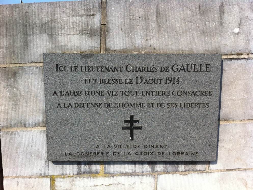
Indeed, Charles de Gaulle, in the opening days of the Great War, fought and was wounded here on this very spot. Alas, the ghost of the good (cough) General was no more able to get me a map than Dinant's city personnel.
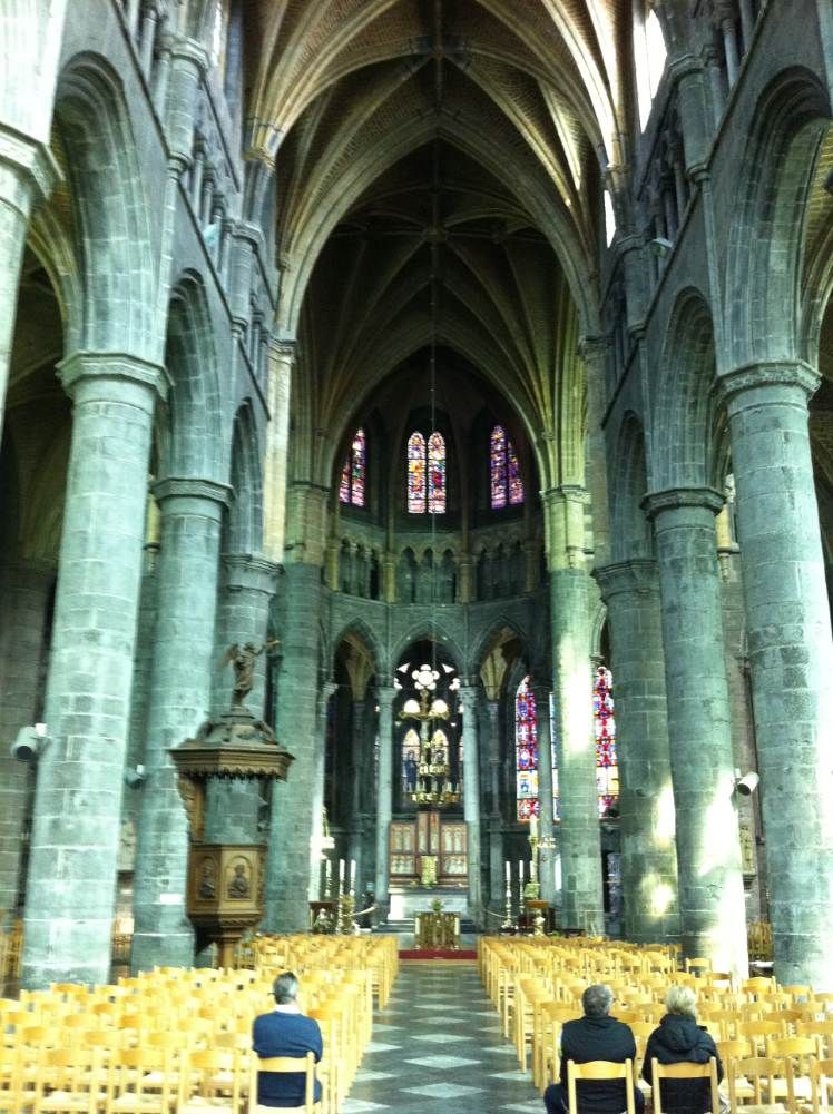
Back on the East Bank it was time for a prayer in the Church of Our Lady:
A couple of streets further I came across three Willy's jeeps, no doubt piloted by WWII buffs:
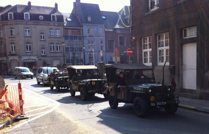
If memory serves it was the designer of a competitor for the contract that missed the order, who was the father of this very versatile vehicle.
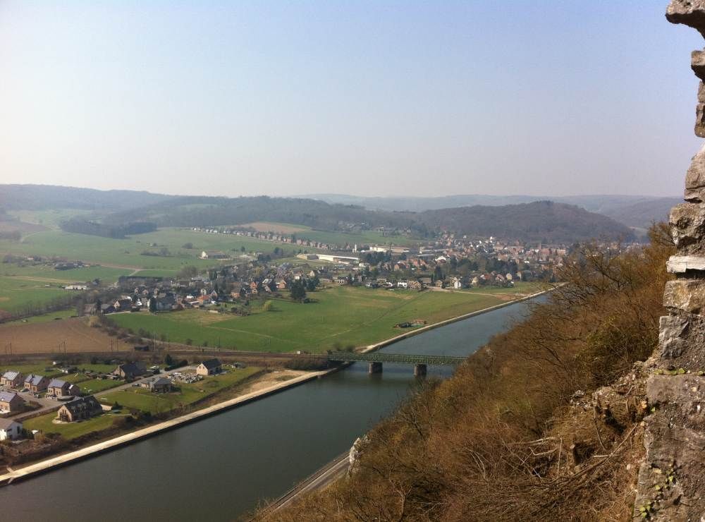
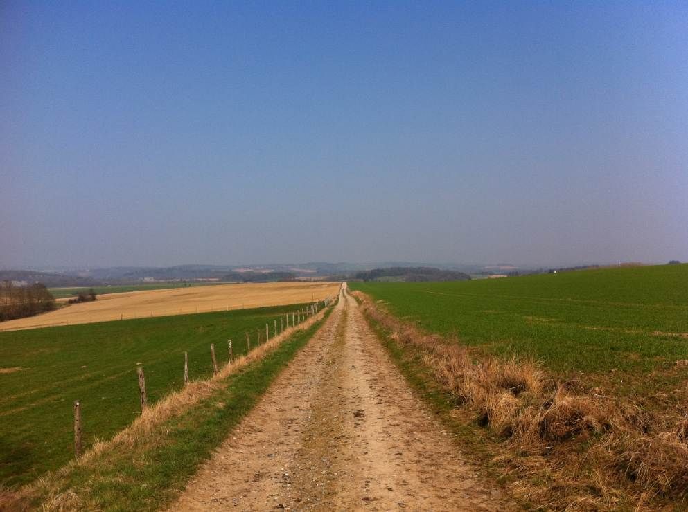
Outlaw wouldn't be Outlaw if he didn't have a plan B though. Just in case I had a book with walking itineraries with me, and I noticed there was a decent walk near the village of Falmignoul, barely seven kloms south of Dinant along the Avenue de General Hodges (who commanded the 1st US Army when it liberated this region in autumn 44). A quick snap with the iPhone of the relevant page - it would have to suffice - and off I was. Pic taken looking back to the north, some one and a half klom out of Falmignoul's centre:
Already on the way back, I veered off the path's way and was rewarded for it with this sight:
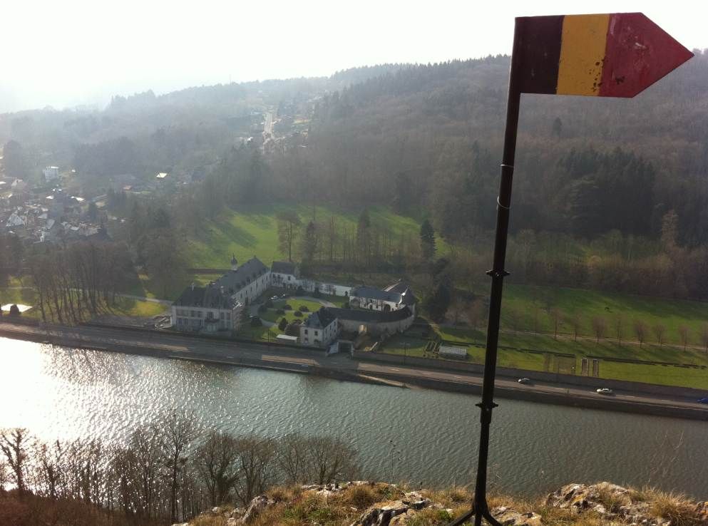
The Chateau de Waulsort, apparently in a slightly better condition than the Chateau de Poilvache. Notice the pennant with the Belgian flag. On these lonely heights, Belgian nationalism is alive and kicking! Ta-daaaaaaa!!!!!
It was about time to wrap the day up. I figured that if I made a detour going home, I would still be able to see two items that for one reason or another had always eluded me. The first one was the small barrage of Ry de Rome, a couple of kloms south of the town of Couvin.
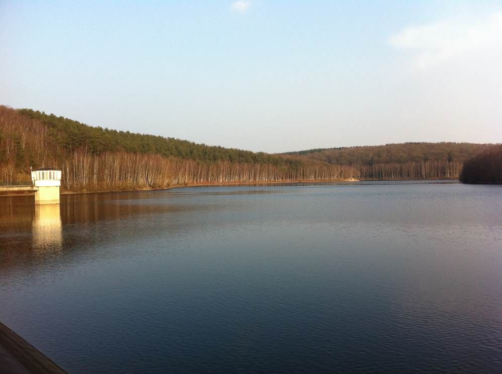
This is not for hydro-electric purposes however, only for distributing drinking water in the region. What did you say? Boring? Yeah, I guess so.
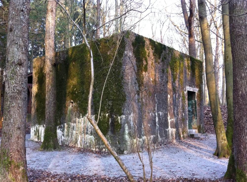
Time for our story's second Adolph. A while back, there used to be this Famous Socialist in Krautland, which is Belgium's eastern neighbor. In 1940, his troops canned the western allies in six weeks. Belgium's army resisted for eighteen days. When Dunkirk was over - btw, the French and the Brits were only able to evacuate 340,000 troops across the Channel BECAUSE of the Belgian Army's resistance - Adolph turned his attention south to finish France and the remainder of its armed forces. He did perhaps not envisage that from then on, France would collapse like bad soufflé. For right after our capitulation, he had the Organisation Todt (I assume it was that organisation) build him a HQ in Belgium's south near the village of Bruly-de-Pesche, whence he intended to monitor the rest of the Feldzug. The pic show the tiny, tiny (so unlike the Fuhrer's grand palns) bunker that was built there in a matter of days. It stands there to this day and you can visit it:
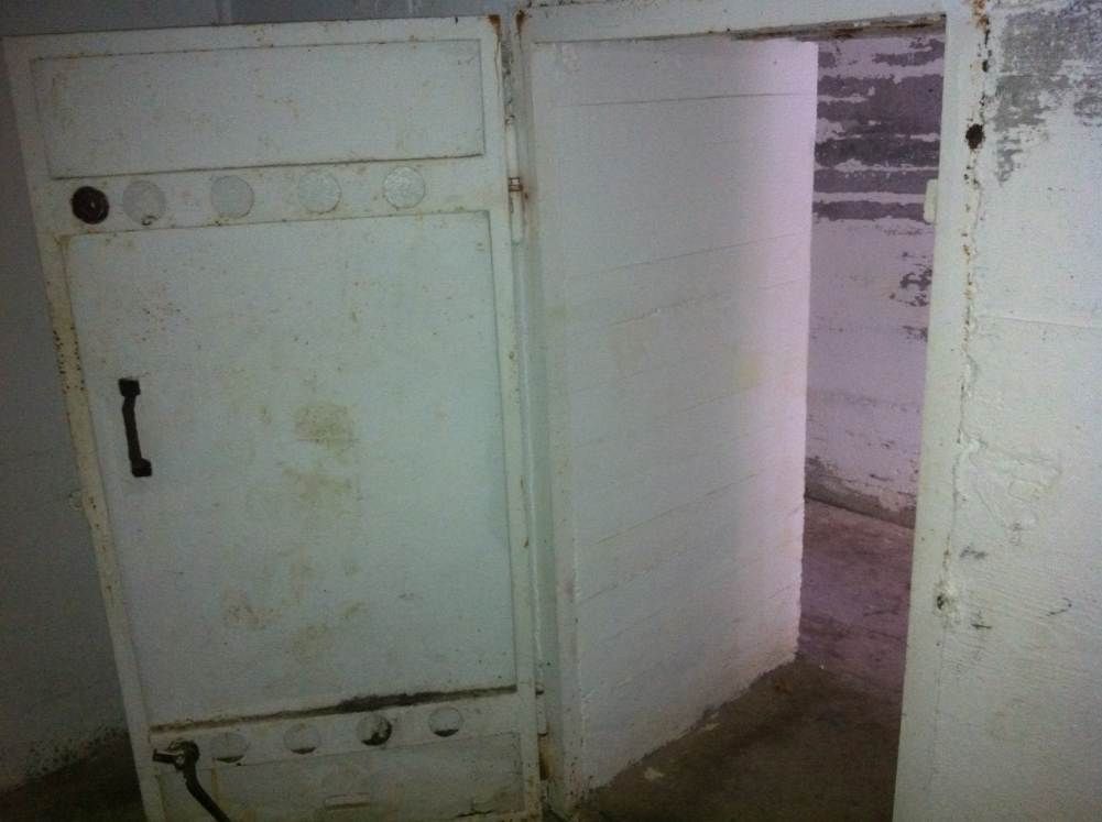
The interior of the mapping room. If only I had had the Fuhrer's Powers on this day, I certainly would have had my walking maps brought to me in no time on a silver platter, exhausted Tourism Bureau fonctionnaires or not.
Adolf was here!!!! BOOOOOOOOOOOOOOOOOOOOO!!!!!!!
On a more serious note, Bruly-de-Pesche not only sports Hitlers first bunker HQ in a foreign country of the war, but also a small chapel commemmorating the Belgian maquisards of the region. On the ceiling, you can read the names of those KIA:
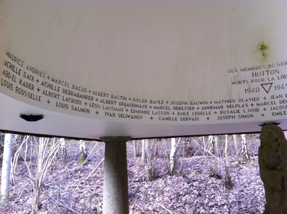
Here are the other ones. I felt that again a little prayer was in order to thank these gentle heroes for their sacrifice.
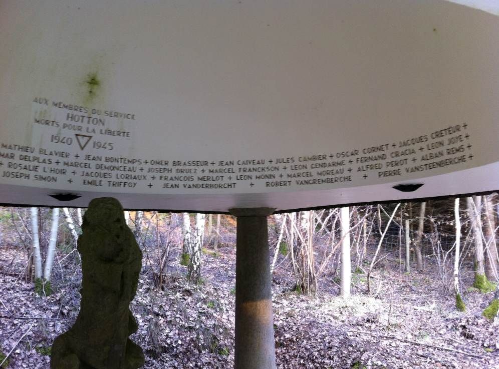
This thinly populated and rather rough area must have offered the Belgian maquis a liberty of action they did not enjoy in Flanders, Belgium's north. Still, I was surprised by the huge number of fatalities.
So. That's all for today. Tomorrow it's time again for being a maquisard myself.
MFBB.
No comments:
Post a Comment